
.png)
YOUR ENGINEERS IN THE SKY


SOLUTIONS
Tenbo Air provides professional drone services to industry-leading firms in engineering, surveying, inspections, mapping, and marketing.
SURVEYS

Low altitude drone scans that integrate traditional high-precision ground survey data for 3D models.
MAPPING


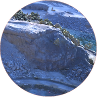
We use commercial drones to create high-resolution maps of large areas of land, for print or digital use.
INSPECTIONS


Visual spectrum and infrared drone surveys to deliver qualitative and quantitative analyses.
MARKETING


Cinematic flyovers and professional drone video production to showcase projects and properties.
FEATURED PROJECTS
Below are a few projects we've worked on. Hover over the project icon to learn more about that project.


Boat hull modeling for Entech Designs naval engineering, in preparation for Coast Guard's "Subchapter M" requirements.

Survey of highway I-10 and I-59 in Slidell, Lousiana for DOTD contractor Barriere Construction.
FAA 333 Exemption: 14561

2014
Year Founded
1400+
Flights Logged
FAA 107.29 Waiver:
107W-2017-03944

Thermography Certified
ITC No: 184134
321
Client Projects
46
FAA Waivers
Louisiana Charter: 41977250K
